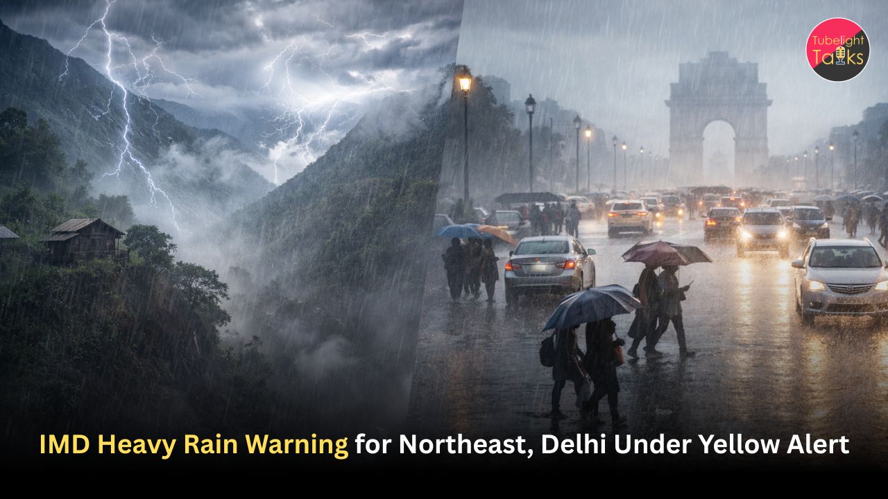
IMD Heavy Rain Warning as Northeast Faces Orange Alert, Delhi Under Watch
The IMD heavy rain warning has put a large part of the Northeast and adjoining eastern Himalayan belt under an orange alert today, with heavy rainfall likely over Arunachal Pradesh, Assam, Meghalaya, Sub-Himalayan West Bengal and Sikkim. News on AIR, citing the IMD, reported the orange warning for these regions on March 28. An IMD all-India weather bulletin also supports the broader rain threat, showing heavy rainfall likely over Arunachal Pradesh, Assam and Meghalaya, along with continued heavy-rain risk in the eastern Himalayan sector.
This makes today one of those weather days where India is dealing with multiple active systems at once. The Northeast is facing a heavy-rain threat, Bihar is among the states facing stronger convective weather, Odisha is under thunderstorm and squall-type warning, and Delhi remains under a yellow alert because of a western disturbance.
Why the Northeast is the biggest concern today
The most serious weather concern is in the Northeast and nearby hill states because the warning there is not just for passing showers, but for heavy rainfall. The IMD-linked reporting says the orange warning covers Arunachal Pradesh, Assam, Meghalaya, Sub-Himalayan West Bengal and Sikkim today.
That matters because orange-level weather usually points to higher disruption risk, including waterlogging, local landslides in hilly terrain, transport slowdown and damage to weaker infrastructure. This is an inference from the intensity category and the terrain involved.
The live weather tools also show that this is not only a paper warning. Guwahati was already under thunderstorms this morning, with IMD-linked severe-weather alerts for the district, while Gangtok showed thunderstorm conditions as well. Those city-level conditions support the broader warning pattern across the region.
What the IMD is saying about Bihar and Odisha
Bihar is facing a stronger storm risk than a routine rain warning. The IMD bulletin says thunderstorm accompanied by hailstorm is very likely at isolated places over Bihar, along with lightning and gusty winds. News on AIR also reported hailstorm risk for Bihar.
Odisha is also under weather threat today, but the official warning I found is more precisely for thunderstorm, lightning and squall-type conditions rather than a confirmed hailstorm alert for today. The IMD subdivision warning for Odisha lists thunderstorm, lightning and squall-related conditions for March 28. So the broader risk to Odisha is real, but the most clearly supported official wording is thunderstorm and gusty-wind activity.
Delhi and north India remain under a yellow alert
Delhi is in a different category from the Northeast, but it is still under active watch. Current reporting says the IMD has issued a yellow alert for Delhi because of rain, thunderstorms and gusty winds driven by an active western disturbance. The national capital also saw light rain earlier, and the morning temperature stayed above seasonal normal even as skies turned unstable.
The weather tool for Delhi shows hazy but warm daytime conditions, which helps explain why today may feel uneven rather than fully stormy throughout. In practice, that means short weather bursts, local gusts and intermittent showers may matter more than all-day rainfall. This is an inference based on the Delhi forecast pattern and the yellow-alert context.
Why today’s weather pattern matters
This is not just a story about whether people need an umbrella. Heavy-rain zones in the Northeast can disrupt roads, aviation and local transport, especially in vulnerable terrain. Storm and hail risk in Bihar can affect crops, power lines and open-area movement. Thunderstorm and squall warnings in Odisha can also create short but sharp disruption.
Meanwhile, Delhi’s alert matters because even moderate storm activity can slow commuting, damage loose structures and create evening traffic stress. These are inferences based on the warning types and affected geographies.
Staying steady in changing conditions
Teachings associated with Sant Rampal Ji Maharaj emphasize calmness, awareness and disciplined conduct during uncertain conditions. In that spirit, unusual weather is a reminder to stay alert without panic and to act with care for one’s own safety and for others. This is a spiritual reflection, not a meteorological claim.
FAQs: IMD Heavy Rain Warning
1. Which states are under the orange warning today?
The orange warning for heavy rainfall covers Arunachal Pradesh, Assam, Meghalaya, Sub-Himalayan West Bengal and Sikkim, according to IMD-linked reporting.
2. Is Bihar facing hailstorm risk today?
Yes. The IMD bulletin says hailstorm is likely at isolated places over Bihar, along with thunderstorm, lightning and gusty winds.
3. Is Odisha under a hailstorm warning too?
The official warning I found for Odisha today is for thunderstorm, lightning and squall-type conditions. Odisha is under weather risk, but the clearest official wording is not a statewide hailstorm warning for today.
4. What is the alert status for Delhi?
Delhi remains under a yellow alert for rain, thunderstorms and gusty winds because of a western disturbance.
5. Is the Northeast already seeing storms on the ground?
Yes. Current weather data showed thunderstorms in places such as Guwahati and Gangtok today, supporting the broader warning pattern.
6. Why is the weather so unstable across regions at once?
Different systems are active at the same time: heavy-rain-producing conditions over the Northeast and eastern Himalayan belt, and a western disturbance affecting north India.
Related Stories


Discussion (0)