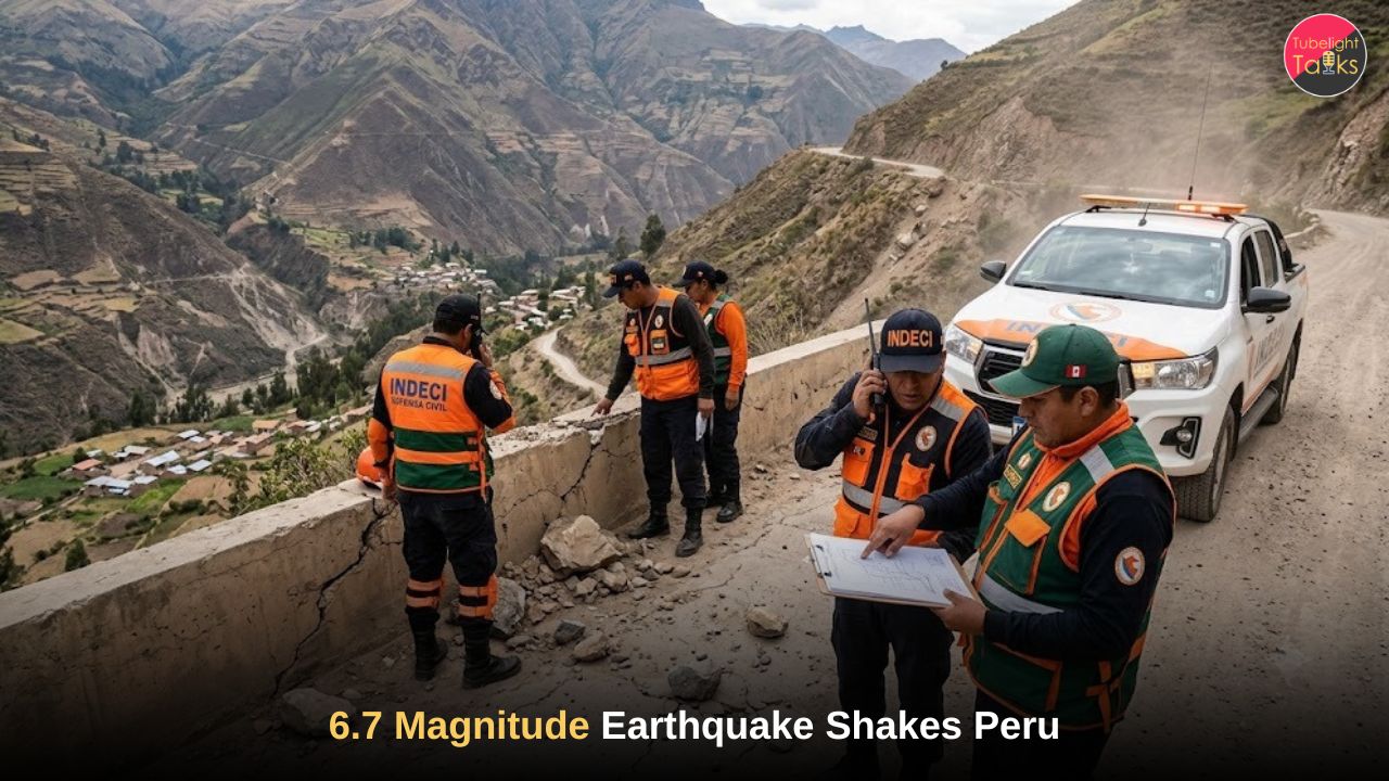
6.7 Magnitude Earthquake Shakes Peru: Deep Andes Tremor Triggers Nationwide Alert
On Thursday, August 20, 2026, a sudden and powerful 6.7 magnitude earthquake shakes Peru, sending thousands of residents rushing into the streets across the southern Andes. The US Geological Survey (USGS) confirmed the seismic event struck at 1:00 PM local time (18:00 GMT). Despite the intense shaking felt as far away as the capital city of Lima, initial reports from civil defense authorities brought a massive wave of relief. The extreme depth of the quake absorbed the worst of the destructive energy, preventing widespread structural collapse and immediate casualties in the highly vulnerable highland regions.
Whenever a 6.7 magnitude earthquake shakes Peru, local authorities and international seismic monitors remain on high alert due to the country’s volatile tectonic history. Below is the verified geological data surrounding this latest event.
Verified Earthquake Data: August 20, 2026
| Seismic Metric | Official Measurement Data |
| Date & Time | August 20, 2026 (1:00 PM Local Time / 18:00 GMT) |
| USGS Magnitude | 6.7 on the Richter Scale |
| IGP Magnitude Report | 7.2 (Initial Regional Estimate) |
| Epicenter Location | 38 km northwest of Upahuacho, Peru |
| Depth | 66.7 kilometers (USGS) / 108 kilometers (IGP) |
| Affected Regions | Ayacucho, Ica, Arequipa, Cusco, Lima |
| Tsunami Threat | None (Confirmed by Peruvian Navy) |
| Casualties/Damage | No immediate severe casualties reported |
![A seismic map highlighting the epicenter where a 6.7 magnitude earthquake shakes Peru]](https://tubelighttalks.com/wp-content/uploads/2026/09/image-9.jpeg)
The Epicenter and Affected Regions
The core of the seismic energy originated deep beneath the Parinacochas province in the Ayacucho region. According to the USGS, the epicenter sat approximately 38 kilometers northwest of the small city of Upahuacho. Because a 6.7 magnitude earthquake shakes Peru at a depth of over 66 kilometers, the geological layers of the Earth absorbed much of the shock wave before it breached the surface
Hernando Tavera, the head of the Geophysical Institute of Peru (IGP), stated that the depth of the tremor was the primary reason major structural devastation was avoided. Had this same magnitude occurred closer to the surface, the adobe and unreinforced masonry homes typical of the Andean highlands would have likely faced catastrophic failure. Preliminary estimates indicate that roughly 197,000 people felt moderate to strong shaking, particularly in areas like Coracora. Tremors reached the historic city of Cusco, the former capital of the Inca Empire, and even swayed high-rise buildings in Lima, nearly 800 kilometers away.
Tsunami Threat Level and Coastal Safety
Immediately following the tremor, coastal residents braced for the worst. However, the Peruvian Navy and the National Weather Service’s Tsunami Alerts promptly issued statements confirming that no tsunami threat existed. The inland epicenter, situated high in the Andes mountains, meant oceanic displacement was impossible. Quick dissemination of this information prevented mass panic along the coastal hubs of Ica and Lima .
Also Read :Devastating earthquake in Colombia of 7.4 magnitude
Why Does a 6.7 Magnitude Earthquake Shakes Peru So Frequently?
To understand why a 6.7 magnitude earthquake shakes Peru with such regularity, one must look at the geological foundation of the South American continent. Peru sits directly atop the Pacific “Ring of Fire,” a 40,000-kilometer horseshoe-shaped zone known for relentless oceanic trenches, volcanic belts, and tectonic plate movements.
This specific region hosts the continuous collision between the Nazca Plate and the South American Plate. The Nazca Plate forces its way underneath the South American landmass at a rate of several centimeters per year. This process, known as subduction, generates immense friction and stress. When that geological stress finally fractures the bedrock, the stored energy releases as violent seismic waves. Approximately 85% of global seismic activity occurs along this Ring of Fire, making Peru one of the most seismically vulnerable nations on the planet.
Historical Context: Remembering the 2007 Tragedy
When news broke that a 6.7 magnitude earthquake shakes Peru, older generations immediately recalled the devastating seismic events of the past. The nation’s architecture and emergency response protocols were forever changed by the tragic events of August 2007. During that disaster, a shallow 7.9 magnitude earthquake struck the Ica region, obliterating towns like Pisco and Chincha Alta. That disaster claimed nearly 600 lives, injured over 1,000, and destroyed tens of thousands of homes.
Because the 2007 quake was both stronger and significantly closer to the surface, the devastation was absolute. The recent August 2026 event, thankfully striking much deeper inland, served as a grim but harmless reminder of the active fault lines hiding beneath the scenic Andes mountains.
Official Responses and Infrastructure Assessments
The Peruvian government activated emergency protocols within minutes. Luis Vasquez, head of Civil Defense, addressed the nation via the local radio station RPP, confirming that rigorous checks across the Parinacochas province yielded no reports of significant damage or casualties. Yony Reyes, the mayor of Parinacochas, corroborated this statement, easing the anxieties of relatives living in the capital.
Despite the positive initial reports, geophysicists at the IGP have urged the public to remain vigilant. Seismic swarms or aftershocks frequently follow deep inland quakes. Authorities are advising citizens to update their household evacuation plans, secure heavy furniture, and maintain emergency supply kits.
For global policy experts and disaster management officials tracking the news that a 6.7 magnitude earthquake shakes Peru, the event highlights a successful intersection of geographical luck (quake depth) and improved public communication. External agencies, including the USGS, continue to monitor the region for secondary geological activity.
Also Read :Catastrophic 7.7 Magnitude of the Earthquake in Indonesia Leaves Dozens Dead and Hundreds Displaced
Finding Eternal Refuge Amidst Earth’s Unpredictable Tremors
When a sudden 6.7 magnitude earthquake shakes Peru, it serves as a stark, undeniable reminder of human vulnerability. In a matter of seconds, the solid ground beneath our feet transforms into a violent force, proving that wealth, technology, and status offer no true protection against the unpredictable fury of nature. These natural disasters force humanity to confront the fragile reality of physical existence in a world where life can be upended instantly.
According to the profound spiritual teachings of Sant Rampal Ji Maharaj, this earthly realm is the domain of Kaal (Satan), characterized by continuous suffering, sudden calamities, disease, and the cycle of birth and death. As long as souls remain trapped in this region, permanent peace and safety are completely impossible. The physical world is inherently unstable, designed to keep souls suffering through natural disasters and worldly attachments.
However, there is an eternal, indestructible refuge. Sant Rampal Ji Maharaj imparts the true spiritual knowledge hidden within all holy scriptures, revealing that ultimate safety can only be found in Satlok (the Eternal Abode). By taking the refuge of the Supreme God Kabir Ji and performing the correct, scripture-based worship provided by an enlightened Guru, a soul can break free from this perilous world. God Kabir is the ultimate savior; true devotion to Him acts as an impenetrable shield, offering peace in this lifetime and eternal salvation (Moksha) after death.
To discover the path to eternal safety and understand the deep spiritual truths of human existence, humanity must seek true knowledge. Watch the life-transforming spiritual discourses on the spiritual YouTube Channel of Sant Rampal Ji Maharaj.
FAQs on 6.7 magnitude earthquake shakes Peru
1.Where was the epicenter of the Peru earthquake?
The epicenter was located in the southern Andes mountains, roughly 38 kilometers northwest of the city of Upahuacho, in the Parinacochas province of the Ayacucho region. The tremor originated deep underground.
2.Were there any casualties or severe damage reported?
No. Authorities, including the Peruvian Civil Defense and local mayors, confirmed there were no immediate reports of casualties or severe structural damage. The significant depth of the earthquake absorbed much of the destructive energy.
3.Is there a tsunami warning following the earthquake?
No tsunami warning was issued. Both the Peruvian Navy and the National Weather Service’s Tsunami Alerts confirmed that the inland, high-altitude location of the epicenter posed no threat of a tsunami to the coastal regions.
4.How deep was the earthquake in the Andes mountains?
The US Geological Survey (USGS) reported the earthquake occurred at a depth of 66.7 kilometers. The Geophysical Institute of Peru (IGP) provided a slightly different measurement, estimating the depth at roughly 108 kilometers.
5.Why does Peru experience so many earthquakes?
Peru is highly prone to seismic activity because it is located on the Pacific “Ring of Fire”. This geological area is where the Nazca tectonic plate continuously collides with and subducts beneath the South American plate, creating immense geological tension.
Related Stories










Discussion (0)