IMD Weather Update: Cold Wave Persists, Dense Fog and Rain Likely in Delhi-NCR, Punjab, Haryana and Himachal Pradesh
IMD Issues Weather Alert: Winter continues to assert its grip across large parts of India as cold wave conditions, dense fog and intermittent rain disrupt daily life in northern and central regions. According to the India Meteorological Department (IMD), Delhi-NCR, Punjab, Haryana and Himachal Pradesh are likely to witness prolonged cold conditions, frequent fog during night and morning hours, and fresh spells of rain and thunderstorms in the coming days.
A new western disturbance is expected to intensify weather activity towards the end of January, bringing rain and snowfall to the western Himalayan region. While North India braces for volatile weather, southern and coastal cities remain comparatively mild.
Key Weather Updates for North and Central India: IMD Cold Wave and Fog Alert
- Cold wave conditions continue across Delhi-NCR, Punjab, Haryana and Himachal Pradesh
- Dense fog expected during night and early morning hours across northern plains
- Fresh western disturbance likely to affect northwest India from the night of January 30
- Rain, thunderstorms and hail reported across parts of North and Central India
- Snowfall and prolonged sub-zero temperatures persist in the western Himalayan region
- Mumbai and parts of Maharashtra placed under yellow alert amid light rain and air quality concerns
Delhi-NCR Weather: Rain, Fog and Temperature Fluctuations
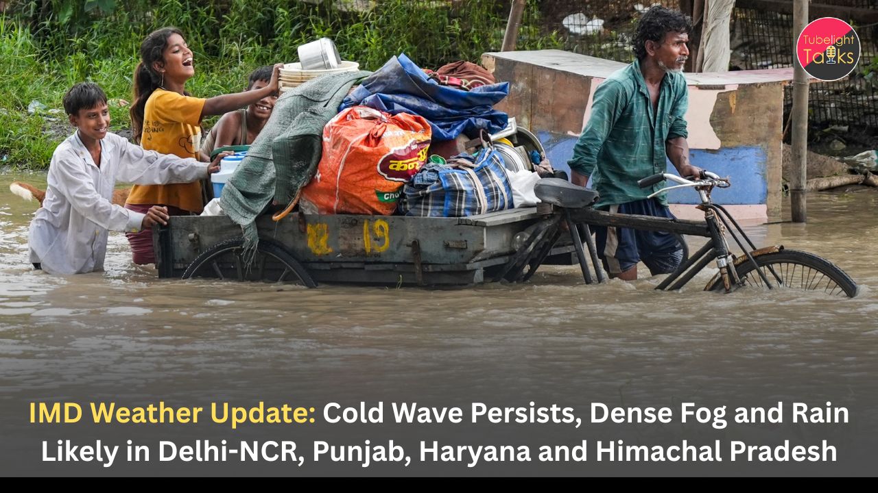
Delhi-NCR experienced a sharp change in weather after rain and thunderstorms lashed several parts of the region earlier in the week. Light to moderate rainfall was recorded in multiple areas, with Palam receiving 3.4 mm, Ridge 3.0 mm and Pitampura 2.0 mm of rain between 8:30 am and 11:30 am. Thunderstorm activity was reported from Narela, Bawana, Alipur, Kanjhawala, Rohini, Mundaka and Jafarpur, prompting the IMD to issue red and orange alerts for several districts.
For January 28, the IMD has forecast generally cloudy skies with shallow fog during morning hours. Maximum temperatures in Delhi are expected to range between 17°C and 19°C, while minimum temperatures may hover between 11°C and 13°C. Noida is likely to witness fog or mist in the early hours, while Gurugram may see comparatively clearer skies during the day.
Rain Forecast for Delhi, Noida and Gurugram in February
The IMD has indicated a fresh spell of rain for the Delhi-NCR region at the start of February. New Delhi is likely to experience one or two spells of rain accompanied by thunderstorms, lightning and gusty winds of 30–40 kmph on February 1. Gurugram may see partly cloudy skies with rain or thunderstorms on February 1 and 2, while Noida is expected to receive light rainfall on February 2.
These weather conditions have already contributed to a noticeable improvement in air quality across parts of Delhi, Noida and Ghaziabad, following strong winds and intermittent rainfall.
Fog and Cold Wave Conditions Across Northern States
Cold wave conditions are expected to persist in isolated pockets of Haryana, Punjab, Himachal Pradesh and Delhi until January 31. The IMD has warned that dense fog during night and early morning hours could significantly reduce visibility, affecting road, rail and air traffic.
Dense fog is likely over Bihar, Haryana, Chandigarh and Delhi, Himachal Pradesh, Madhya Pradesh, Punjab, Rajasthan and Uttar Pradesh on January 28 and 29. Similar conditions are expected in Uttarakhand on January 29 and 30. Cold day conditions may occur in isolated areas of Himachal Pradesh, while cold wave conditions may continue over Punjab, Haryana and Chandigarh through the end of the month.
Also Read: Mission Mausam BharatFS 2025 Glory: 6km Panchayat Forecasts Shield New India’s Skies
Central India Witnesses Rain and Hailstorms
Parts of central India, particularly Madhya Pradesh, experienced sudden rain and hailstorms, affecting districts such as Sehore, Agar Malwa, Shajapur, Gwalior and Ujjain. Heavy rainfall was reported in areas including Sehore, Ashta, Jawer, Mehatwada and Shyampur, while Bhopal witnessed thunderstorms during evening hours.
Hailstorms briefly but intensely impacted standing wheat and gram crops, raising concerns over potential yield loss. Power supply disruptions were also reported in some localities. The IMD attributed the weather activity to an active cyclonic circulation over Haryana and an associated trough line influencing central India.
Western Himalayas Brace for Snowfall as Disturbance Approaches
The western Himalayan region continues to experience severe winter conditions. Jammu and Kashmir remains under intense cold, with temperatures staying well below freezing, especially at night. Forecasts indicate prolonged sub-zero conditions, persistent cold winds and snowfall over higher reaches.
The IMD has stated that a fresh western disturbance is likely to affect northwest India from the night of January 30, with its impact becoming more pronounced on February 1 and 2. Thunderstorms with lightning and gusty winds of 40–50 kmph are expected over Jammu and Kashmir, Ladakh and Punjab on February 1, while Haryana and Delhi may experience gusty winds of 30–40 kmph.
Mumbai and Maharashtra: Light Rain and Air Quality Concerns
Mumbai and its neighbouring regions may witness light spells of rain, with the IMD issuing a yellow nowcast alert for Mumbai and Thane. The alert, issued at 7 am, warned of light rainfall over the next three hours. The city is likely to record a maximum temperature of around 29°C and a minimum of 16°C.
Colaba reported a minimum temperature of 22.4°C, while Santacruz logged 22.6°C. Mumbai’s overall Air Quality Index stood at 121, placing it in the “moderate” category. Several areas across the city recorded moderate AQI levels, while Navi Mumbai reported satisfactory air quality.
Yellow alerts have also been issued for districts including Dhule, Nandurbar, Jalgaon, Sambhajinagar, Jalna and Parbhani, warning of thunderstorms, lightning and gusty winds of 30–40 kmph.
Southern and Coastal Regions Remain Mild
Southern and coastal regions continue to experience relatively stable weather conditions. Chennai remains hot and humid with temperatures around 30°C and no significant rainfall expected. Bengaluru and other parts of Karnataka have seen partly overcast skies, soft winds and daytime temperatures averaging around 29°C. Ahmedabad continues to enjoy dry conditions with clear skies and daytime temperatures near 25°C.
Understanding Life’s Uncertainty Through the Spiritual Knowledge of Saint Rampal Ji Maharaj
Amid changing weather patterns, natural disruptions and human vulnerability, the spiritual teachings of Saint Rampal Ji Maharaj offer a deeper perspective on life and nature. His unique knowledge explains that natural events are governed by supreme laws of creation and serve as reminders for humanity to seek true spiritual wisdom.
According to his teachings, material challenges—whether caused by climate, health or circumstance—highlight the temporary nature of worldly existence. Saint Rampal Ji Maharaj emphasises devotion based on complete spiritual knowledge, righteous conduct and understanding the true purpose of human life as the ultimate path to inner peace and lasting well-being.
What the Changing Winter Pattern Means for India
India’s winter weather remains highly dynamic as cold wave conditions, dense fog and intermittent storms continue to impact northern and central regions. While the IMD has forecast a gradual rise in minimum temperatures by 2–5°C after January 29, chilly nights, fog-related disruptions and unseasonal rain are likely to persist in the coming days.
Authorities have advised residents to remain cautious, follow weather advisories closely and take necessary precautions as the season enters its final but volatile phase.
FAQs on IMD Issues Weather Alert: Cold Wave, Dense Fog, Rain and Snow Forecast Across India
1. Which states are affected by the cold wave and dense fog according to IMD?
Cold waves and dense fog are affecting Delhi-NCR, Punjab, Haryana, Himachal Pradesh, Rajasthan, Uttar Pradesh, Bihar and parts of Madhya Pradesh, mainly during night and morning hours.
2. When is rain expected in Delhi, Noida and Gurugram?
IMD has forecast rain with thunderstorms in Delhi on February 1, in Gurugram on February 1 and 2, and light rain in Noida on February 2.
3. What is the impact of the western disturbance mentioned by IMD?
The western disturbance may cause rain, thunderstorms and snowfall over northwest India and the western Himalayan region between January 30 and February 2.
4. Why has air quality improved in Delhi and Mumbai recently?
Rainfall and strong winds have helped reduce particulate matter, leading to temporary improvement in air quality across parts of Delhi-NCR and Mumbai.
5. Will cold wave conditions ease soon in North India?
IMD expects a gradual rise of 2–5°C in minimum temperatures after January 29, though cold nights and fog may continue in northern plains and hill regions.
Related Stories


Discussion (0)