Remote Sensing of Soils: Advancing Agricultural Land, Use Planning with Precision Mapping
With the increasing demand for sustainable agriculture, remote sensing technology has emerged as a powerful tool for soil mapping, classification, and evaluation. By using satellite imagery and geospatial analysis, agricultural planners can make data-driven decisions to enhance land productivity and soil health.
News Highlights
- Remote sensing enables precise soil mapping using satellite data.
- Helps in soil classification and fertility assessment.
- Enhances agricultural land use planning and sustainability.
- Supports precision farming by optimizing resource allocation.
- Detects soil degradation and guides conservation efforts.
Agricultural land use planning relies on accurate soil data to optimize farming practices. Remote sensing, through satellite imagery and GIS (Geographic Information Systems), has revolutionized soil assessment by providing real-time, large-scale data on soil properties, moisture levels, and fertility.
Using multispectral and hyperspectral sensors, remote sensing identifies soil texture, organic matter content, and nutrient availability, assisting in precise classification. This technology allows farmers and policymakers to implement site-specific agricultural practices, reducing waste and improving yields.
By integrating remote sensing with AI and machine learning, predictive models can forecast soil degradation, erosion risks, and climate impact on agricultural lands. This proactive approach supports sustainable farming and food securit sensing
What is Remote Sensing?
Remote sensing is the process of gathering information about the Earth’s surface without direct contact by using sensors on satellites, aircraft, drones, or ground-based instruments. These sensors detect and record electromagnetic radiation (light, heat, radio waves, etc.) reflected or emitted by objects, helping scientists analyze landscapes, climate, and environmental changes.
Types of Remote Sensing:
1. Passive Remote Sensing
- Relies on natural energy sources (like the Sun).
- Examples: Optical satellites (Landsat, Sentinel), aerial photography.
2. Active Remote Sensing
- Uses artificial energy sources (like radar and LiDAR) to illuminate objects and measure the reflected signals.
- Examples: Synthetic Aperture Radar (SAR), LiDAR (Light Detection and Ranging).
Applications of Remote Sensing in Soil Mapping & Agriculture:
- Soil Moisture Monitoring –
Detects water content in soil using microwave sensors.
- Soil Texture & Composition Analysis – Identifies clay, sand, and organic matter using multispectral and hyperspectral imaging.
- Erosion & Land Degradation Detection – Tracks soil erosion, desertification, and deforestation.
- Precision Agriculture –
Helps farmers optimize fertilizer use, irrigation, and land management.
What technologies are used in soil remote sensing?
Several advanced technologies are used in soil remote sensing to analyze and map soil properties. These include:
1. Multispectral Imaging
- Captures images in multiple wavelengths of light (visible, near-infrared, and shortwave infrared).
- Helps in identifying soil moisture, organic matter, and mineral composition.
2. Hyperspectral Imaging
- Provides detailed spectral data with hundreds of bands.
- Enables precise classification of soil types, nutrient content, and contamination levels.
3. LiDAR (Light Detection and Ranging)
- Uses laser pulses to measure surface elevation.
- Useful for soil erosion assessment, topographic mapping, and drainage analysis.
4. SAR (Synthetic Aperture Radar)
- Uses microwave signals to penetrate clouds and vegetation.
- Effective in monitoring soil moisture and detecting changes in land use.
5. Thermal Infrared Sensors
- Measure soil temperature variations.
- Helps assess soil moisture and heat retention capacity.
6. GIS (Geographic Information Systems)
- Integrates remote sensing data with spatial analysis.
- Supports land suitability assessments and precision agriculture.
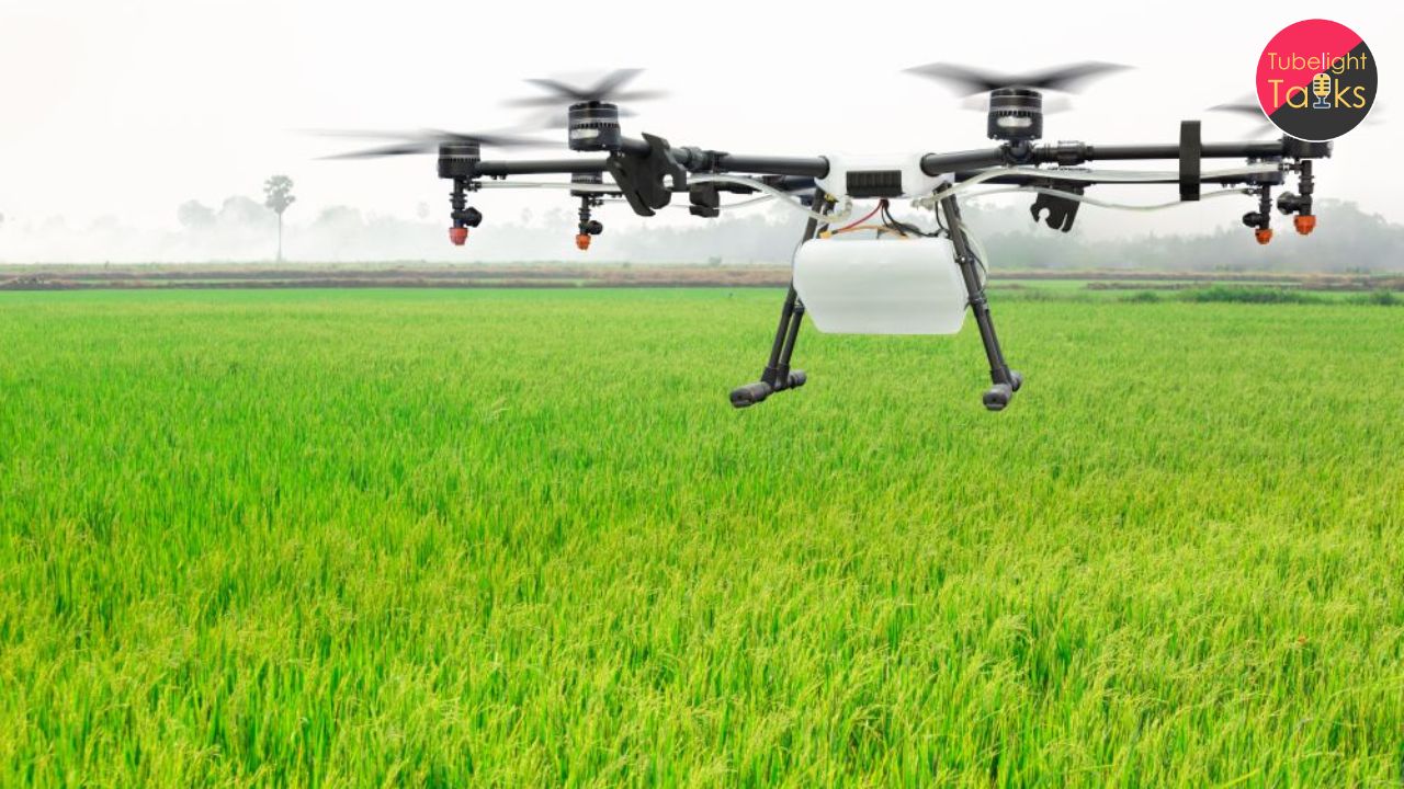
7. UAVs (Unmanned Aerial Vehicles) / Drones
- Provide high-resolution real-time imagery.
- Useful for localized soil monitoring and crop health analysis.
8. Spectroradiometers
- Measure reflected light from soil to determine its properties.
- Used in laboratory and field conditions for detailed soil analysis.
9. GNSS (Global Navigation Satellite Systems) & GPS
- Helps in georeferencing remote sensing data for accurate mapping.
By combining these technologies, remote sensing offers precise and large-scale soil assessment, supporting sustainable agriculture and land management.
Mapping Land, Mapping Life: How The Role of Remote Sensing and Spirituality in Human Progress
Remote sensing technology has revolutionized soil assessment and agricultural land-use planning, offering precise, large-scale insights into soil health, fertility, and degradation. By integrating satellite imagery, GIS, and AI-driven analytics, farmers and policymakers can make data-driven decisions to enhance sustainability, optimize resource allocation, and ensure food security. These advancements in technology contribute to a future where agriculture becomes more efficient, resilient, and environmentally conscious.
However, while technological innovations continue to shape modern agriculture, true sustainability goes beyond material progress. As emphasized in the teachings of Sant Rampal Ji Maharaj, human life is not solely about material achievements but also about understanding the divine principles that govern existence. Just as remote sensing provides a deeper insight into the land’s potential, spirituality helps us explore the true purpose of life. Sant Rampal Ji Maharaj explains that aligning our actions with God’s Constitution—which promotes righteousness, compassion, and truth—ensures not only material well-being but also spiritual fulfillment.
Just as farmers carefully nurture the soil to yield a good harvest, humans must cultivate devotion and righteousness to attain ultimate salvation (Moksha). Without a deep-rooted spiritual foundation, all worldly advancements remain incomplete. By embracing true spiritual knowledge and devotion to the Supreme God Kabir, individuals can achieve a balanced, prosperous, and meaningful life, ensuring both worldly success and eternal bliss.
Thus, as we harness technology to improve agriculture and sustainability, we must also remember to cultivate our spiritual soil—our soul—through Sat-Bhakti (True Worship) under the guidance of a Tatvadarshi (True Spiritual Saint), as highlighted by Sant Rampal Ji Maharaj.
Frequently Asked Questions (FAQs):
Q1: How does remote sensing help in soil mapping?
Remote sensing uses satellite imagery to analyze soil properties, moisture levels, and fertility, aiding in precise classification and mapping.
Q2: Can remote sensing improve agricultural productivity?
Yes, by providing accurate soil data, remote sensing helps farmers optimize irrigation, fertilization, and crop selection for better yields.
Q3: What technologies are used in soil remote sensing?
Technologies include multispectral imaging, hyperspectral analysis, LiDAR, and GIS for comprehensive soil evaluation.
Q4: Is remote sensing cost-effective for small farmers?
Yes, with advancements in technology and government support, remote sensing is becoming more accessible and affordable for all farmers.
Related Stories


Discussion (0)